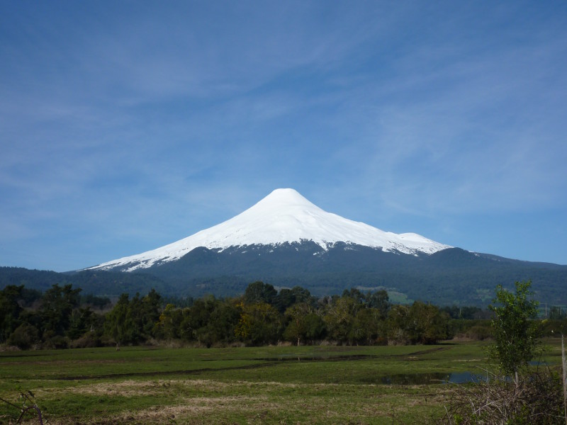
Volcán Osorno
Access
The ski road up to the Osorno ski area is unusual, in that it is paved all the way from Ensenada. However, you may find getting to Ensenada tricky, depending upon when you travel. We arrived from the north, so the logical route was to leave the Panamericana at Osorno, and follow the road directly to Ensenada on the North side of Lago Llanquihue. This proved a bad idea, as the last short section to Ensenada was blocked by a landslide. They are working on improving the road anyay (planned to reopen at the end of November 2011). This meant a long drive round to Puero Varas, and taking the southern approach to Ensenada, also through lots of roadworks.
With this volcano, unlike others, you are supposed to register. The CONAF office is clearly signposted, and the ranger we met was very friendly. You have to fill a form out, and there is no fee. One of the questions asks which countries you have climbed in, so it is actively encouraged to brag! There is an extremely long list of equipment that you are supposed to have. I didn't even read it all, figuring I had what was necessary. Mainly they wanted to know if we had rope/harness/axe/helmet/crampons, a phone/VHF, and a means of navigating. They are essentially trying to minimise the chance of having to mount a rescue, which I can see why. Of course, they cannot determine if you can actually use any of the equipment you have, but that's another matter altogether! Once you return, you need to let the ranger know you are down. In our case, he was watching us through binoculars through the day, so he knew we were back anyway. In poor weather, this wouldn't be the case.
The route
The ascent route is easy, particularly if it is clear. Follow the piste initially, then to the top of the chair. From there, take a rising traverse round the slope facing the top of the chair into a wide gully which you ascent to it's top. Work your way up a small dome and onto a large plateau area. Pay particular attention to the ground leading to this dome from above, as this point is a particularly small target, and could be easily missed in poor weather on your return. I recommend you mark the position with your GPS, if you are carrying one.
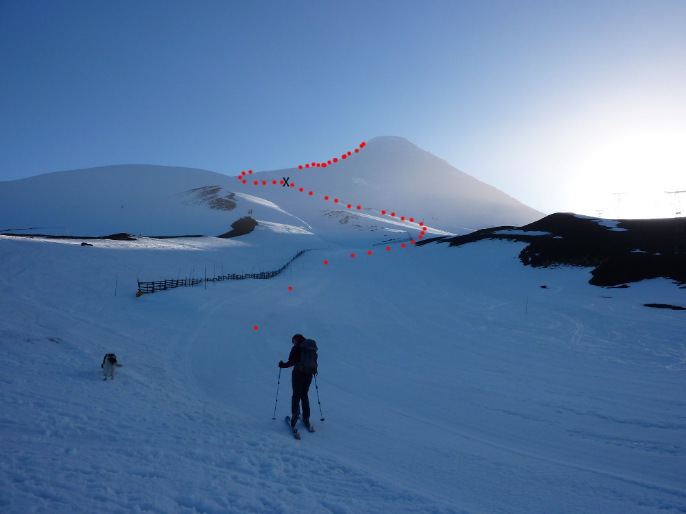

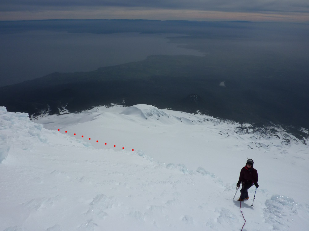
The summit cone was quite steep and icy, and we wore crampons from just above the plateau. The upper part of the mountain is glaciated, and on the summit cone, there was a crevasse off to our left as we ascended. Worth bearing in mind. The summit area carried a crown of steep rime ice around it. We took a slight spiral ascent, curving round towards the North side of the summit cone, before cutting up to the top. Since we had the rope with us, we used that on this section, but it would barely be Grade 1 back home. It may be easier if you continued further tound to the North side. The summit area is almost flat, and I left a ski pole at the point we arrive on the summit plateau, so that our ascent route would be easy to find on the way back. The top itself (2662m) seemed to be on a corniced edge. I didn't get too close, so don't know what size of drop there was, but the view of Puntagiudo and Tronador was stunning.
On the descent, you will see why the rangers are anxious to try and ensure that the people on the mountain can look after themselves. The small dome that you ski over to get back to the ski area seems really small from above, and it could easily be missed while skiing across the plateau below the summit cone. Too far to the left, and you enter a gully with some seracs to contend with. Too far to the right, and you will find yourself a long way from the ski area very quickly.
Accommodation
We stayed at the Teski Refugio, just below the main carpark at the ski area. There weren't many people staying (during the week), so it was quiet. It was CLP 11000 each per night (about £13), using our own sleeping bags on the bunks and including breakfast. They do evening meals in the bar, which are reasonably priced. They said that as it was quiet, we could use the kitchen to cook, but we decided not to. The view from the large windows over Lago Llanquihue is stunning. It was a nice place to relax and have a beer. They only take cash.